


Graham Voting District, Tazewell County, Virginia
About
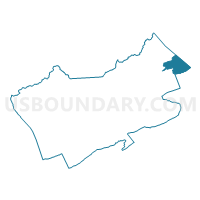
Outline

Summary
| Unique Area Identifier | 682641 |
| Name | Graham Voting District |
| County | Tazewell County |
| State | Virginia |
| Area (square miles) | 11.33 |
| Land Area (square miles) | 11.32 |
| Water Area (square miles) | 0.01 |
| % of Land Area | 99.94 |
| % of Water Area | 0.06 |
| Latitude of the Internal Point | 37.24046180 |
| Longtitude of the Internal Point | -81.27454110 |
Maps


Graphs
Select a template below for downloading or customizing gragh for Graham Voting District, Tazewell County, Virginia


Neighbors
Neighoring Voting District (by Name) Neighboring Voting District on the Map
- Voting District 15, Mercer County, WV
- Voting District 2, Mercer County, WV
- Voting District 33, Mercer County, WV
- Voting District 37, Mercer County, WV
- Voting District 4, Mercer County, WV
- Falls Mills Voting District, Tazewell County, VA
- Rocky Gap Voting District, Bland County, VA
- Springville Voting District, Tazewell County, VA
- Tip Top Voting District, Tazewell County, VA
Top 10 Neighboring County Subdivision (by Population) Neighboring County Subdivision on the Map
- District I, Mercer County, WV (18,572)
- Northern district, Tazewell County, VA (9,243)
- Eastern district, Tazewell County, VA (9,011)
- District 4, Bland County, VA (1,569)
Top 10 Neighboring Place (by Population) Neighboring Place on the Map
Top 10 Neighboring Unified School District (by Population) Neighboring Unified School District on the Map
- Mercer County School District, WV (62,264)
- Tazewell County Public Schools, VA (45,078)
- Bland County Public Schools, VA (6,824)
Top 10 Neighboring State Legislative District Lower Chamber (by Population) Neighboring State Legislative District Lower Chamber on the Map
- State House District 6, VA (73,250)
- State House District 3, VA (66,212)
- State House District 24, WV (17,083)
Top 10 Neighboring State Legislative District Upper Chamber (by Population) Neighboring State Legislative District Upper Chamber on the Map
- State Senate District 38, VA (175,805)
- State Senate District 10, WV (106,143)
- State Senate District 6, WV (93,502)
Top 10 Neighboring 111th Congressional District (by Population) Neighboring 111th Congressional District on the Map
Top 10 Neighboring Census Tract (by Population) Neighboring Census Tract on the Map
- Census Tract 211, Tazewell County, VA (6,049)
- Census Tract 202, Tazewell County, VA (5,354)
- Census Tract 17, Mercer County, WV (5,326)
- Census Tract 22, Mercer County, WV (4,649)
- Census Tract 402, Bland County, VA (2,923)
- Census Tract 21, Mercer County, WV (2,894)
- Census Tract 20, Mercer County, WV (2,834)
- Census Tract 208, Tazewell County, VA (2,191)